Fayl:Balkan-range-satellite.jpg

Sınaq göstərişi ölçüsü: 800 × 562 piksel. Digər ölçülər: 320 × 225 piksel | 640 × 450 piksel | 1.024 × 719 piksel | 1.280 × 899 piksel | 2.379 × 1.671 piksel.
Faylın orijinalı (2.379 × 1.671 piksel, fayl həcmi: 691 KB, MIME növü: image/jpeg)
| Bu fayl "Vikimedia Commons"dadır və digər layihələrdə istifadə edilə bilər. |
 |
Faylın təsvir səhifəsinə get |
Xülasə
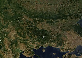
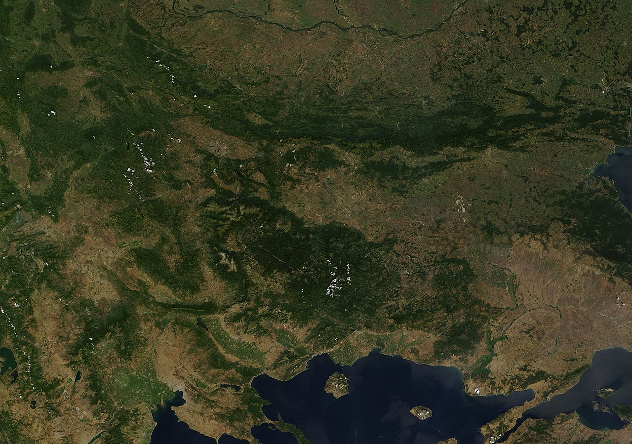
| İzah | Satellite image of the Balkan mountains (Stara Planina). The mountain range is running across the territory of Bulgaria. |
| Mənbə | NASA, Image:Satellite image of Greece.jpg |
| Müəllif | User:Introvert |
| İcazə (Faylın təkrar istifadəsi) |
Original image from NASA, cropped Image:Satellite image of Greece.jpg |
Lisenziya
| This file is in the public domain in the United States because it was solely created by NASA. NASA copyright policy states that "NASA material is not protected by copyright unless noted". (See Template:PD-USGov, NASA copyright policy page or JPL Image Use Policy.) | ||
 |
Warnings:
|
Faylın tarixçəsi
Faylın əvvəlki versiyasını görmək üçün gün/tarix bölməsindəki tarixlərə klikləyin.
| Tarix/Vaxt | Kiçik şəkil | Ölçülər | İstifadəçi | Şərh | |
|---|---|---|---|---|---|
| indiki | 23:38, 21 dekabr 2005 | | 2.379 × 1.671 (691 KB) | Introvert | {{Information| |Description=Satellite image of the Balkan mountains (Stara Planina). The moutain range is running across the territory of Bulgaria. |Source=NASA |Date= |Author=User:Introvert |Permission=Original image from NASA, cropped |other |
Fayl keçidləri
Aşağıdakı səhifə bu faylı istifadə edir:
Faylın qlobal istifadəsi
Bu fayl aşağıdakı vikilərdə istifadə olunur:
- arz.wikipedia.org layihəsində istifadəsi
- ast.wikipedia.org layihəsində istifadəsi
- ba.wikipedia.org layihəsində istifadəsi
- be.wikipedia.org layihəsində istifadəsi
- br.wikipedia.org layihəsində istifadəsi
- ca.wikipedia.org layihəsində istifadəsi
- ceb.wikipedia.org layihəsində istifadəsi
- ckb.wikipedia.org layihəsində istifadəsi
- da.wikipedia.org layihəsində istifadəsi
- eo.wikipedia.org layihəsində istifadəsi
- eo.wikiquote.org layihəsində istifadəsi
- eu.wikipedia.org layihəsində istifadəsi
- fr.wikinews.org layihəsində istifadəsi
- fr.wikivoyage.org layihəsində istifadəsi
- ga.wikipedia.org layihəsində istifadəsi
- ia.wikipedia.org layihəsində istifadəsi
- kab.wikipedia.org layihəsində istifadəsi
- kcg.wikipedia.org layihəsində istifadəsi
- ku.wikipedia.org layihəsində istifadəsi
- sv.wikipedia.org layihəsində istifadəsi
- tg.wikipedia.org layihəsində istifadəsi
- tt.wikipedia.org layihəsində istifadəsi
- vec.wikipedia.org layihəsində istifadəsi
- www.wikidata.org layihəsində istifadəsi